3D terrain map

  • Estado: Closed
  • Premio: $75
  • Propuestas recibidas: 15
  • Ganador: deta3d2

Resumen del concurso

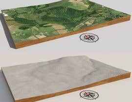
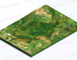
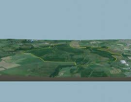
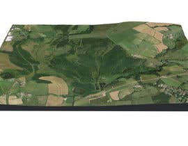
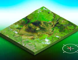
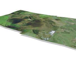
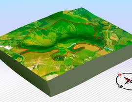
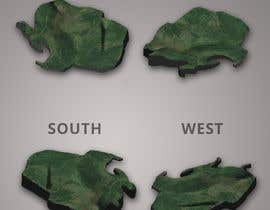
Convert a Google Earth image into a 3D terrain map. Deliver results in appropriate programme and also in 4 PDFs showing views form North, South, East and West. I've marked in red the area that I'm interested in seeing in the context of the surrounding countryside. I'd like the marked area and land 500m around it to be shown

Habilidades recomendadas

Principales propuestas de este concurso

Ver más participaciones

Tablero de aclaración pública

  • EfraimVF
    EfraimVF
    • 4 años atrás

    Please extend the delivery time, to send my proposal.

    • 4 años atrás
  • parthamikh
    parthamikh
    • 4 años atrás

    Hi, Please send top view image of the area(not tilted) and make sure North direction to the top. It is hard to find marked area. Thanks

    • 4 años atrás
  • alvarobasilys
    alvarobasilys
    • 4 años atrás

    Can u share the coordinate?

    • 4 años atrás
    1. mumbaipete
      Organizador del concurso
      • 4 años atrás

      You can use the postcode CA28 8YD. This is for the industrial unit at the north west tip of the site. I would like to see the site in the wider context of the area so can show show land for 500m all around the site as well. Thanks

      • 4 años atrás

Cómo comenzar con los concursos

  • Publica tu concurso

    Publica tu concurso Fácil y rápido

  • Recibe montones de propuestas

    Consigue toneladas de propuestas De todo el mundo

  • Elige la mejor propuesta

    Elige la mejor propuesta ¡Descarga fácilmente los archivos!

Publica un concurso ahora o únete a nosotros hoy